Mogollon Rim During Arizona Monsoon Season

When one thinks of awesome geological features in Arizona, Grand Canyon, Antelope Canyon, and Monument Valley are top of mind. However, another stunning feature is theMogollon Rim which provides breathtaking views. The best way to experience the “Rim” is via Forest Road 300 during the Arizona Monsoon season.
If you are not familiar with Mogollon Rim or the Arizona Monsoon Season, I will provide some background.
The Rim
The Mogollon (pronounced muggy-on) Rim is a massive 200-mile wall of rock that defines the southwestern edge of the Colorado Plateau. This feature starts near Arizona’s border with New Mexico and stretches diagonally across most of the state. In many places, the rock face drops as much as 2,000 feet. Standing on the edge, you are presented with the most far-reaching scenery in Arizona. You can see Mt Lemon over 260 miles away on a clear day.
Arizona Monsoon Season
Arizona Monsoon Season runs from June 15th to September 30th. Ok, I know when you hear the word Monsoon, Arizona is not the first place that comes to mind. The definition of monsoon is a seasonal change in the direction of a region’s prevailing or strongest winds. This definition fits as winds change direction and bring moisture from the Gulf of Mexico and the Gulf of California into the state. This moist air is heated as it passes over the desert, and when it reaches the Mogollon Rim, the air is lifted to create Thunderstorms. During this season, thunderstorms along the Rim are almost a daily occurrence. This may not be the best time to camp on the Rim, but it is the best time for photography as the monsoon clouds provide superb backdrops to the fantastic views along the Mogollon Rim.
Forest Road 300
This road runs along the edge of the Rim and provides many lookouts and hiking trails. The quickest way to get to a location to take in the view is to travel east on Highway 260 from Payson, AZ, for 29 miles; as soon as you finish the last climb onto the Rim, take the first left onto Forest Road 300. At this point, you find yourself at 7,500 feet in elevation.
Just before turning onto Forest Road 300, you see the impact of the Monsoon rains. The Monsoon rains feed the many vernal pools along the Rim. After the rain, these pools spring to life with flowers and are teaming with many types of amphibians and insects.
 Golden Vernal PoolAlong the Mogollon Rim, there are many Vernal Pools. Most Vernal Pools in other regions come to life in the spring, getting their water from snowmelt. However, here, these pools have two seasons, spring and the rains of the Arizona Monsoon Season. These rains quickly transformed what was a dry meadow a few days before into a lush pool with a sea of yellow flowers.
The first section of Forest Road 300 is paved, and there are several viewpoints along this portion of the road. One of our favorites is Rim Lakes Vista Point.
Rim Lakes Vista Point is very popular for folks who do not have time to explore the rest of the area. This location provides a great view and allows folks to take in the area’s splendor.
If you have time, several other areas are worth checking out. They can be a bit harder to spot, but they allow you to get off the main road and walk to the edge. As you travel west, the road turns to a graded gravel road after the turn-off for Woods Lake. Even though it is gravel, this road is suitable for passenger cars at least to the top of the Rim.
Forest Road 9350
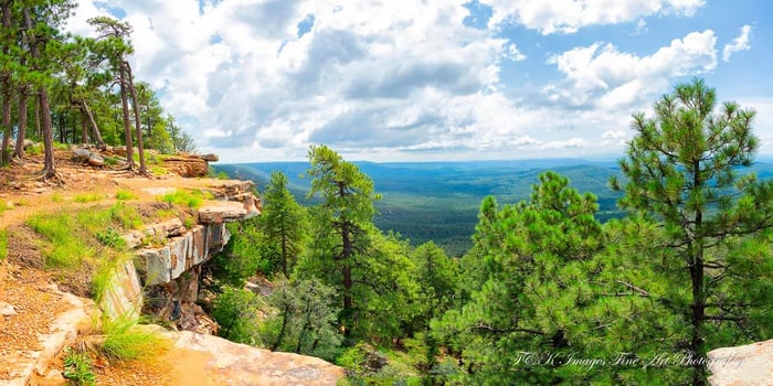
One great side road is Forest Road 9350. This route is a short side road off Forest Road 300. This road offers another opportunity to walk up to the edge of the Rim. Here you have a great view of the valley below and the hills beyond, and this spot allows you to see the sheer drop off of the cliffs.
We took advantage of the Monsoon clouds, giving us this great filtered light that brings out the colors of the trees and the rocks.
Bear Canyon Lake Road
Bear Canyon Lake is one of the many lakes off Forest Road 300. At an elevation of 7,500, Bear Canyon Lake is surrounded by a mixture of conifer, oak, and aspen trees. As the lake is located several miles down a dirt road and the lakeside is only accessible by foot, we routinely find ourselves alone along the shore of this beautiful, narrow, canyon-bound lake.
That was the case on the day we captured this photograph. There were several thunderstorms in the area when we arrived, and we had to pause our hike to allow a storm to pass by. Once the storm passed, we hurried down the steep trail to the lake. Our efforts were rewarded with this photograph.
The storm clouds provided a natural filter, lighting the entire area without shadows. The thunderstorm is headed away with its menacing-looking clouds reflecting in the lake.
Back On Forest Road 300
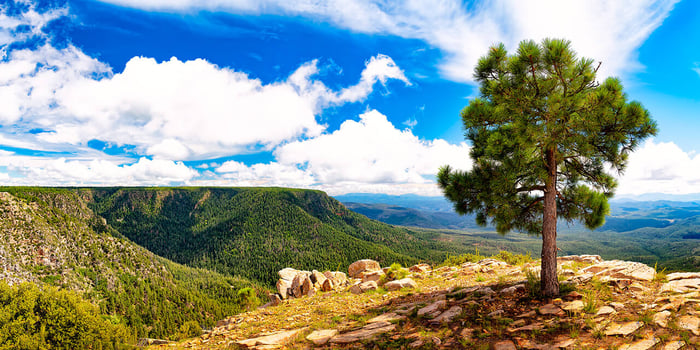
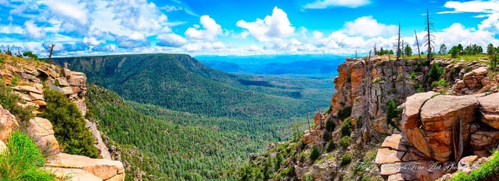
But the best spot is 10 miles along where you come to the top of the Rim. At 7900 feet, the forest gives way to an open area of rock and a scattering of trees. From here, you can hike out to a large open space. Leaving the car behind and walking along the trail, you come to this spot where the land drops away, affording you this incredible view of the forest below and the hills in the background.
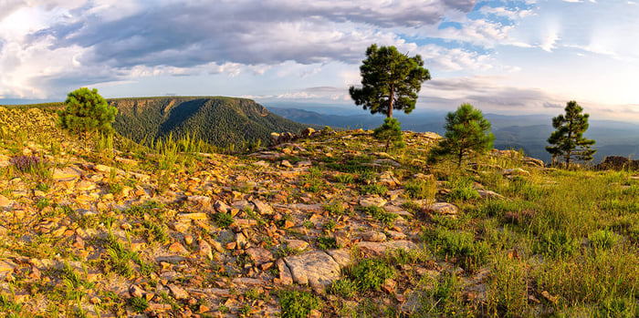
Continuing along the trail, you find yourself on a section of the Rim that jets out and forms a point, providing you with a 270-degree view of the valley below. As this is one of the highest points along the Rim, trees are a rarity. Here the most prominent feature is the rocks. Teresa named this image Rock Garden for the many wildflowers that are starting to bloom between the stones.
I found myself captivated by this lone tree at the end of the point. This tree was somehow managing to survive in what has to be a harsh environment. This is evident when you examine the top of the tree or where the top should be, as it appears to have been topped by a lightning strike.
To give you a taste of the view from this spot, I have created a short video from this location.
* * *
Loved this article? Sign up for our newsletter. Be the first to get amazing new photos and interesting stories sent to your inbox.
Like what you see, click on any image to add to your collection.
About the Author:
Keith Peters, co-owner of T&K Images, is driven by a passion to explore and capture the world's beauty through light and lens. Our mission is to bring the extraordinary essence of Earth into your space through breathtaking art.
All images are the exclusive copyright property of T&K Images.


